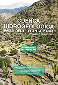
Miscelánea 23
Primeras Páginas
Dr. Alfredo Tineo | Adrián Ruiz
Descargar trabajo en formato PDFResumen
La cuenca hidrogeológica del Valle de Santa María forma parte de la Provincia Hidrogeológica de los Valles Intermontanos de las Sierras Pampeanas y se desarrolla desde Punta de Balasto, en la Provincia de Catamarca, hasta sobrepasar la localidad de Cafayate en la Provincia de Salta.
Es una larga y estrecha depresión estructural, limitada por bloques de rocas metamórficas y plutónicas, con afloramientos de un complejo sedimentario de edad Mesozoica – Terciaria y por depósitos aluviales de edad Cuaternaria que constituyen los principales acuíferos de la zona.
La cuenca tiene un marcado déficit hídrico, con precipitaciones que no superan los 200 mm anuales en la zona baja, incrementándose en las altas cumbres, con una elevada evapotranspiración.
Se realizó una evaluación de los antecedentes de la zona y se confeccionó un mapa geológico de base, destacándose la zona pedemontana y las áreas más bajas del valle, donde se encuentran las áreas favorables desde el punto de vista hidrogeológico.
En base a este modelo, se programaron los estudios geofísicos, en una red de sondeos eléctricos verticales que permiten cubrir toda el área de interés, controlados con información de perforaciones existentes. Posteriormente, se trazaron perfiles geoeléctricos, a fin de correlacionar los horizontes eléctricos más destacados.
De esta manera, se realizó un modelo conceptual del acuífero en el valle, determinándose la profundidad de los niveles saturados (techo del primer acuífero) y profundidad de los niveles limo arcillosos, que conforman el “basamento hidrogeológico” de la zona.
El estudio geofísico, realizado por primera vez en el valle en forma sistemática, permitió determinar los espesores de mayor interés, determinando niveles profundos saturados que no habían alcanzado las perforaciones existentes, lo que posibilitó incrementar el cálculo de las reservas de agua en el subsuelo del valle.
Se determinaron las características hidroquímicas y, en base a la información geológica, geofísica e hidrogeológica, se formularon las conclusiones y recomendaciones para las futuras explotaciones de los recursos hídricos subterráneos.
Finalmente, se destaca la gran importancia que tienen los reservorios de agua subterránea en la zona, cuya explotación racional será la base para el desarrollo del valle y también una opción para poder mitigar las variaciones futuras por el cambio climático global.
Abstract
The hydrogeological basin of the Santa Maria Valley River is part of the Intermountain Valley hydrogeological province of the Sierras Pampeanas, it evolves/runs from Punta de Batastro in Catamarca to beyond Cafayate in Salta. Morphologically it is represented by a long and narrow structural depression limited by metamorphic and plutonic rocks, with some Tertiary-Mesozoic strata, all caped by Quaternary alluvial deposits that represent the main aquifer of the area. The basin has a high level of evapotranspiration and strong hydric annual deficit. Rainfalls are not higher than 200 mm annually in the valley, slightly rising at the mountain tops.
The current project analyzed early papers, and a geological map was done focusing on the mountains piedmont and the lowest areas of the valley from a hydrogeological point of view. Based on this model, geophysical
studies were programmed in a network of electrical sounds which allowed the coverage of the whole target area and a comparison of the
information on existing wells. Afterwards, geoelectric profiles were drawn in the order to correlate outstanding electric units. Thus, the
conceptual model of the aquifer in the valley was complete, determining the depth of the saturated levels (top of the first aquifer) and depth of the silt-clay levels, which shape the hydrogeological basement of the area.
This book presents the first integrated systematic geophysical study in the valley which allowed to determine the thickness, the deepness of saturated levels not reached by existing wells, and to increase the calculation of the ground water reservoirs in the valley region. The hydrochemical of saturated levels not reached by existing wells, and to increase the calculation of the ground water reservoirs in the valley region. The hydrochemical characteristics were determined, and conclusions were drawn based on the geological, geophysical, and hydrogeological information.
In addition, some suggestions were made for the future exploitation of the underground hydric resources. Finally, the significance of the ground water reservoirs is highlighted, providing some recommendations to continue with rational exploitation as the basis for the future development of the valley.


